The Bukk Mountains form the largest continuous limestone plateau in Hungary. Spread across northeastern Hungary between the towns of Eger and Miskolc, this region offers some of the most rewarding hiking in the country, yet it remains surprisingly quiet compared to popular destinations further west.
Understanding the Bukk
The Bukk range is part of the North Hungarian Mountains and sits within Bukk National Park, which was established in 1977. The plateau itself averages around 800 to 900 metres in elevation, with the highest point being Istvankut at 959 metres. What makes the Bukk distinctive is not its height but its character. The plateau is a vast, gently rolling expanse of beech forest and meadow, riddled with sinkholes, caves, and rocky outcrops.
I first visited in autumn 2020 and found myself completely unprepared for how atmospheric the plateau feels. In October, the beech forests turn a deep copper colour, and the morning mist sits in the valleys in a way that makes the place feel genuinely ancient. I have returned every season since then, and each visit reveals something different.
Getting There
From Budapest, the most practical approach is by train to either Eger (about two hours) or Miskolc (two and a half hours). Both towns serve as good bases, though Eger is the more pleasant place to stay.
From Eger, local buses run to Szilvasvarad, which is the main trailhead for the northern Bukk. The bus takes about 45 minutes. From Miskolc, buses run to Lillafured and Bukkszentkozma, which give access to the eastern and central parts of the range.
Driving is easier for flexibility, but parking at popular trailheads fills up on weekends from May through October. Arriving before 9:00 in the morning avoids the worst of it.
Transport Summary
- Budapest to Eger: 2 hours by train (InterCity, runs hourly)
- Eger to Szilvasvarad: 45 min by local bus
- Budapest to Miskolc: 2.5 hours by train
- Miskolc to Lillafured: 30 min by bus (route 15)
Szalajka Valley: The Classic Walk
The Szalajka Valley near Szilvasvarad is the most popular walking route in the Bukk, and for good reason. The valley follows a clear stream through beech forest, past small waterfalls and a trout farm, up to a rocky spring where the stream emerges from the limestone. The walk to the spring and back is about 6 kilometres and takes two hours at a comfortable pace.
The valley is well-maintained with a gravel path and wooden bridges. It is accessible for families and does not require any technical skill. The trout farm about halfway up the valley sells smoked trout, which makes a good trail lunch.
What most visitors miss is that the valley is just the starting point. From the rocky spring at the head of the valley, trails continue upward onto the Bukk plateau. The climb is steady but not difficult, gaining about 300 metres over two kilometres. Once on the plateau, the landscape opens up completely.
The Plateau Circuit
My favourite walk in the Bukk is a circuit that starts from the top of Szalajka Valley, crosses the plateau to the Istvan-lapat meadow, continues to the Bukk summit area, and descends via Nagymezovirago back to Szilvasvarad. The full circuit is about 18 kilometres and takes six to seven hours including stops.
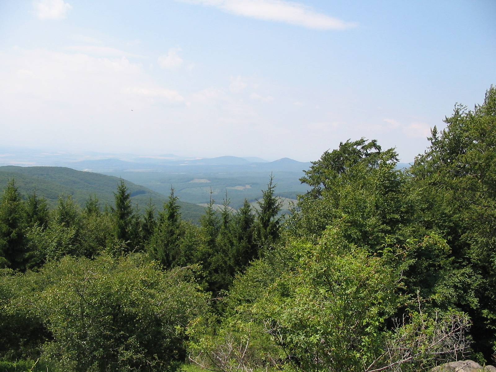
The plateau section is the highlight. The trail runs through dense beech forest that opens periodically into meadows called polyanok. In spring, these meadows are covered with wildflowers. In autumn, the beech canopy overhead turns extraordinary shades of orange and gold. In winter, the plateau can be snow-covered from December through February, and the walking changes character entirely.
Navigation on the plateau is straightforward if you follow the trail markings. The main route is marked with blue stripes (part of the National Blue Trail), with local variants in red, yellow, and green. Junctions are marked with signs indicating distances and times to the next named point.
Lillafured and the Eastern Bukk
Lillafured is a small resort town on the eastern edge of the Bukk, built around a lake and a waterfall. The town itself has a slightly faded grand hotel and a narrow-gauge railway that runs to Miskolc. From Lillafured, trails lead westward onto the plateau and southward along a ridge toward Eger.
The walk from Lillafured to the Anna Cave (Annabar-lang) follows a path through the forest above the lake. The cave is a small limestone formation with tuff deposits and is worth a short visit. The walk to the cave and back takes about an hour.
For a longer hike, the trail from Lillafured to Bukkszentkozma via the ridge is about 14 kilometres. The route follows the red-stripe marking through mixed forest with periodic viewpoints. The terrain is rolling rather than steep, and the path surface is mostly good.
Practical Considerations
Water
Water sources on the plateau are limited. The springs marked on maps are seasonal and may be dry in late summer. I always carry at least two litres for a full day walk. Szilvasvarad and Lillafured both have shops where you can stock up before heading onto the trails.
Weather
The plateau is exposed and conditions change quickly. Summer thunderstorms can arrive with very little warning, and temperatures on the plateau are typically 5 to 8 degrees cooler than in the valleys. A waterproof layer and a warm mid-layer are worth carrying even in summer.
Season
The best months for walking are May, June, September, and October. July and August are warmest but also see the most visitors. Winter walking is possible with appropriate gear, though some trails become icy on north-facing slopes.
Accommodation
Szilvasvarad has several guesthouses and a campsite. Eger offers a much wider range, from budget hostels to comfortable hotels. On the plateau itself, the only shelter is the Bukk National Park's mountain huts, which are basic stone buildings with no services. For current information about the park, the Bukk National Park Directorate maintains a regularly updated website.
Route Summary
- Szalajka Valley: 6 km round trip, 2 hours, easy
- Plateau Circuit from Szilvasvarad: 18 km, 6-7 hours, moderate
- Lillafured to Anna Cave: 3 km round trip, 1 hour, easy
- Lillafured to Bukkszentkozma ridge: 14 km, 5 hours, moderate